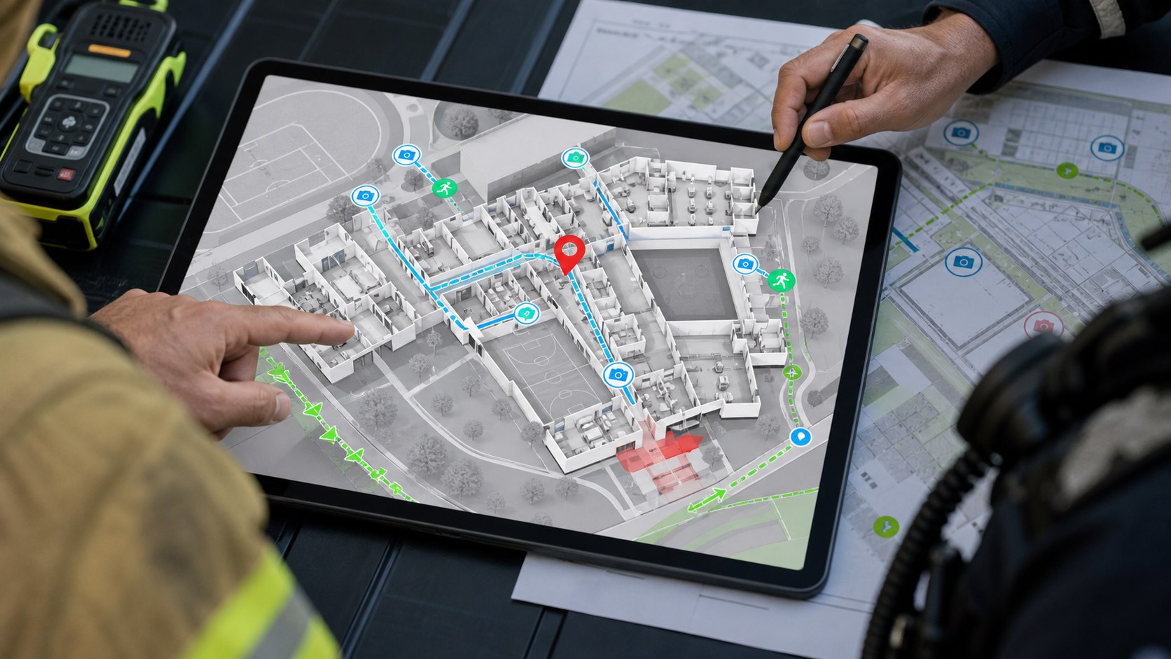
Critical incident mapping uses detailed digital school maps to improve location, coordination, and response during emergencies.
What it means
Critical incident mapping consists of creating digital maps with high operational utility for schools: buildings, floors, classrooms, entrances, cameras, keys, zones, gathering points, hydrants, emergency access, and other data that helps response during an incident.
It is not only cartography. It is information prepared so school teams, public safety, and first responders share the same representation of the campus under pressure.
Why it appears in K12
During an emergency, a postal address is not enough. In large campuses or campuses with multiple buildings, seconds are lost if responders do not know where to enter, where the classroom is, which door is blocked, or which camera shows the zone.
The Iowa program cited in K12 news describes critical incident mapping as a tool for schools and responders to visualize emergencies and critical information on digital maps, with the goal of reducing response times.
Useful data in an operational map
- Buildings, floors, classrooms, and coherent numbering.
- Entrances, exits, routes, and access points for responders.
- Cameras, intercoms, panic buttons, locks, and sensors.
- Restricted or high-priority zones.
- Locations of keys, AEDs, first-aid kits, and critical equipment.
- GIS or indoor mapping layers compatible with external systems when applicable.
Relationship with Clipxu
Smart Location, Policy Manager, and AI alerts gain value when they are placed on a useful map. An alert such as "person in restricted zone" or "panic button activated" should indicate where it occurs, which nearby assets can provide context, and which protocol applies.
The map also helps review incidents afterward: times, routes, affected zones, event sequence, and improvement opportunities.
Reference sources
- Iowa Department of Education, School Safety: https://educate.iowa.gov/pk-12/operation-support/school-facilities/school-safety
- GeoComm, Iowa Critical Incident Mapping Project: https://www.geocomm.com/iowa-critical-incident-mapping-project/